I recently watched a three-part documentary on Curiosity Stream called “Celts: The Untold Story”. Like most Curiosity Stream videos, it is very interesting and entertaining. But like many Curiosity Stream videos, particularly those dealing with prehistory, its fundamental message is simply wrong.
One of the major points of this documentary was that the Celts began with the Hallstatt Culture as a community of humble salt-traders in a tiny Alpine village. This to me is blatantly, even ridiculously, false. Proposing this effectively ignores the continuity of the successive cultures of Central Europe from the Bell Beaker period of the early Bronze Age through to the late Iron Age La Tène Culture. It’s also suspiciously reminiscent of the story of the Roman Empire originating from a single settlement called Rome that was allegedly founded by the twins Remus and Romulus.
By the way, this particular documentary isn’t the only one on Curiosity Stream that I’ve strongly disagreed with. There is also one about the Egtved Girl that has everything to do with promoting a feminist message of empowerment for young women rather than presenting the truth. As if a young woman could have traveled by herself over hundreds of miles through deep forests in prehistoric Europe without dying one way or another…
Watching this “Celts: The Untold Story” documentary prompted me to produce a series of maps that show the original settlement of the Yamnayan Proto-Celts in Central Europe and the areas of the subsequent Celtic cultures in Central Europe from the early Bronze Age to the late Iron Age. These maps do not show the spread of the Celtoid offshoot of the Celts into northwestern Europe (see https://vellaunos.ca/2021/03/26/celtic-and-celtoid/ ), nor do they show the migration of Celts into Iberia that produced the Celtiberians, nor do they show the area of the Lepontians in northern Italy (I still have my doubts about these being Celtic).
Map 1 – The expansions of the South Indo-European Yamnaya ancestors of the Celts from the Pontic Steppe along the Danube River valley – c3100 to c2600 BC
Map 2 – The extent of the Eastern Bell Beaker Culture representing the origin of the Celts – c2600 to c2300 BC – (The earliest Italic peoples, of South Indo-European Yamnaya origin and thus closely related to the earliest Celts, probably occupied the lower portion of the Danube valley at this time) (Further expansions to the northwest during this period eventually produced the Celtoid offshoot of the Celts)
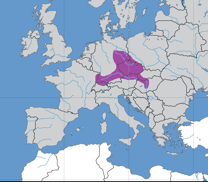
Map 3 – The extent of the Unetice Culture (north part) and the Danubian Early Bronze Age (south part) – c2300 to c1600 BC – (These two groups may represent diverging Celtic cultures, the Unetice Culture eventually disappearing and being partly absorbed by the Danubian Early Bronze Age, which spawned the later Celtic cultures of Central Europe)
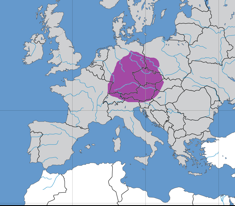
Map 4 – The extent of the Celtic Tumulus Culture that developed from the Danubian Early Bronze Age, showing a loss of territory in the north but expansion both eastwards and westwards – c1600 to c1200 BC – (Celts expand into what is now eastern France)
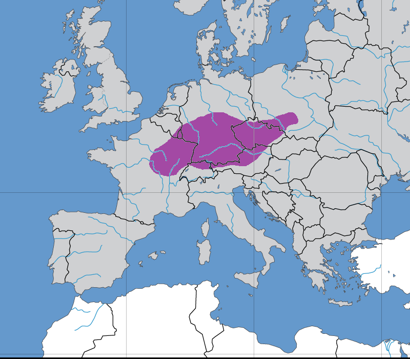
Map 5 – The extent of most of the Urnfield Culture without the Northwestern and Transdanubian areas (possibly West Germanic and P-Italic respectively) – c1300 to c750 BC – (Celtic begins to replace Celtoid in southeastern Britain (i.e. Brittonic) and expands further into what is now northern France) (The Celtoid offshoot of the Celts occupies most of the area of the Atlantic Bronze Age during this period)

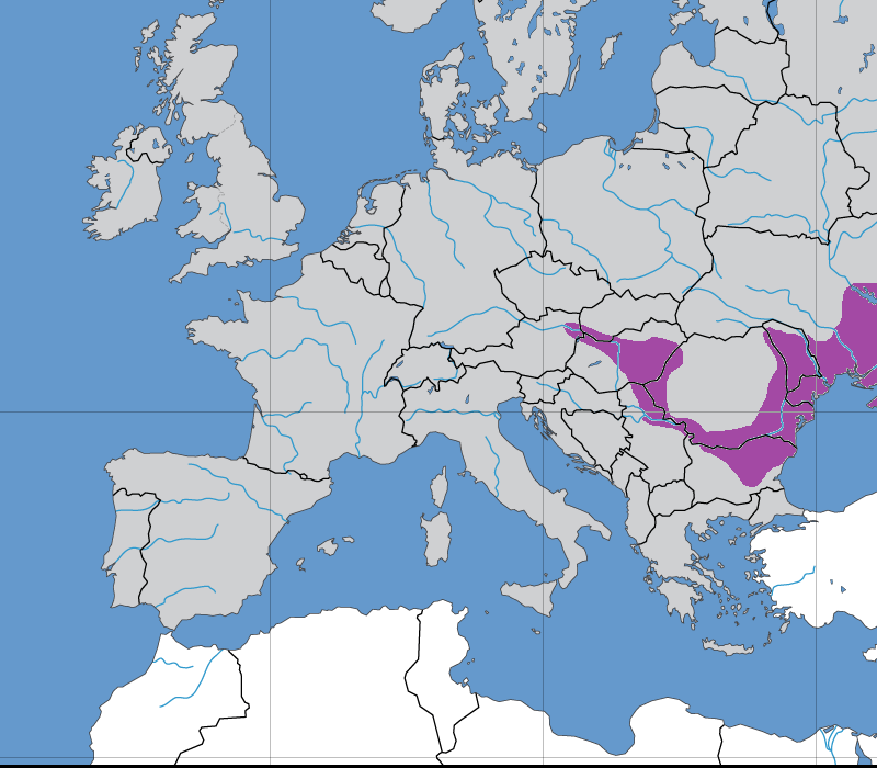
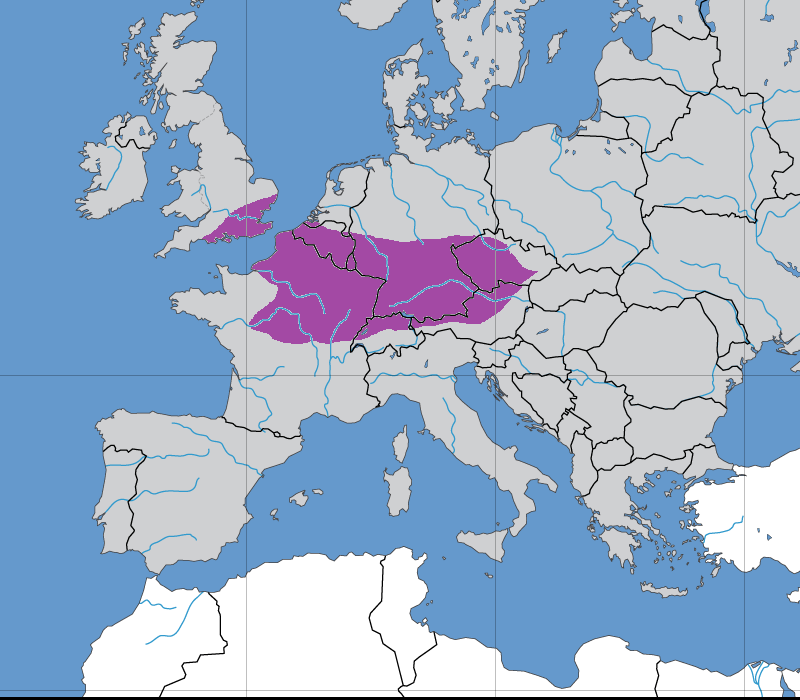
Map 6 – The extent of the Hallstatt Culture – c800 to c450 BC – (Celtic expands over most of what is now France, but without necessarily replacing Celtoid in most areas)
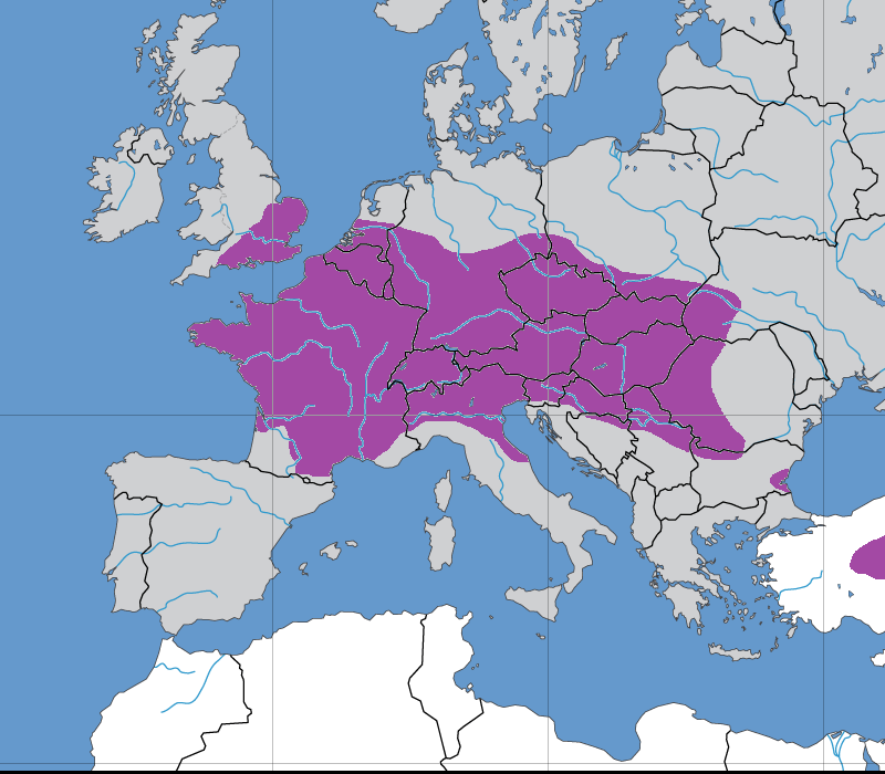
Map 7 – The maximum extent of the La Tène Culture – c450 to c1 BC – (Time of map c200 BC) (The Brittonic variety of Celtoid persists in most of southern Great Britain, as does the Goidelic variety of Celtoid in Ireland)
